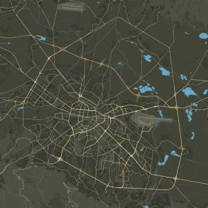
Gevgeliyski quarter, officially designated as the “Gevgeliyski” residential complex, stands as a distinctive district within the Bulgarian capital Sofia, positioned in the northwestern part of the city and forming part of the “Ilinden” district. The area is delineated by Tsaritsa Joanna Boulevard to the south, Vardar Boulevard to the east, and Bogdantsi Street to the west, creating a triangular layout.
This neighborhood has a historical origin rooted in the aftermath of the First World War when Bulgarian refugees from the South Macedonian town of Gevgeli and Gevgeliisko resettled in Sofia. The allocation of land for construction was facilitated under the guidance of Dimitar Dinev, reflecting a testament to the resilience and adaptive spirit of the Bulgarian population during challenging times.
**Location:**
The Gevgelija district, with its distinct triangular shape, is delimited by Tsaritsa Joanna Boulevard to the south, Vardar Boulevard and its northern extension to the east, and “Bogdantsi” street and the “Sofia-Pernik” railway line to the north, where West Park commences.
**History:**
Following the Ilinden-Preobrazhensky Uprising and the subsequent upheavals in Macedonia, many Macedonian Bulgarians sought refuge in Bulgaria. The neighborhoods of today’s “Ilinden” region gradually formed, with the Gevgeli district primarily populated by refugees from Gevgeli and surrounding areas. Street names in the neighborhood carry the historical memory of their places of origin, honoring the legacy of Macedonian villages and heroes.
**Transportation:**
The central transport artery of the neighborhood is “Tsaritsa Joanna” Boulevard, facilitating the passage of bus No. 77. Additionally, the “Vardar” metro station of the first diameter (metro lines M1 and M4) of the Sofia Metro is strategically located along the boulevard, enhancing the connectivity of the district to broader city networks.
**Architecture:**
Architecturally, the Gevgelii district features predominantly large-panel constructions, specifically from the Bs-VIII-Sf and Bs-69-Sf series, developed from the late 60s to the end of the 80s. The landscape also includes EPK blocks, small brick structures from the 60s, and recent residential buildings, showcasing the evolution of architectural styles over the years.
**Education:**
While the neighborhood itself does not house schools or kindergartens, nearby educational institutions in the “Sveta Troitsa” and “Zapaden Park” neighborhoods cater to the educational needs of the residents. The closest hospital is situated in the “Ilinden” district, namely the MBAL National Cardiology Hospital.
Among the neighboring schools are the 3rd Secondary School “Marin Drinov,” PGTE “Henry Ford,” 17th Secondary School “Damyan Gruev,” the Professional High School of Food Technology “Prof. Dr. G. Pavlov,” and the 135th secondary school “Jan Amos Comenius,” contributing to the educational diversity of the surrounding areas.

